
Solo Winter Ascent of Mt. Bancroft's East Ridge - photos – Winter Training for Grand Traverse Ski Race
Sunday, February 22nd, 2009
I first heard about this climb through Dougald
McDonald’s blog. It struck me as a fun, relatively quick, short-drive
(always a huge plus) adventure. The climbing was rated 5.2 and there is a
rappel along the ridge, but Dougald thought both might go safely without a
rope. Since I couldn’t find a partner for this adventure, I hoped so. I still
brought a rope and some slings to make a harness, just in case I couldn’t
manage the downclimb. I also brought an ice axe and Microspikes. As it turned
out, I didn’t use any of that gear. I was to solo the ridge in my bare XC ski
boots. This ridge is stellar! It is a superb winter (or summer for that matter)
adventure. There is continuously interesting scramble once you start up this
ridge with nice exposure down both sides. It is highly recommended. 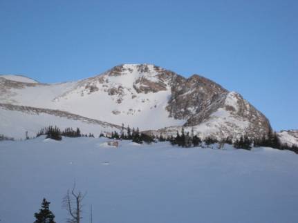
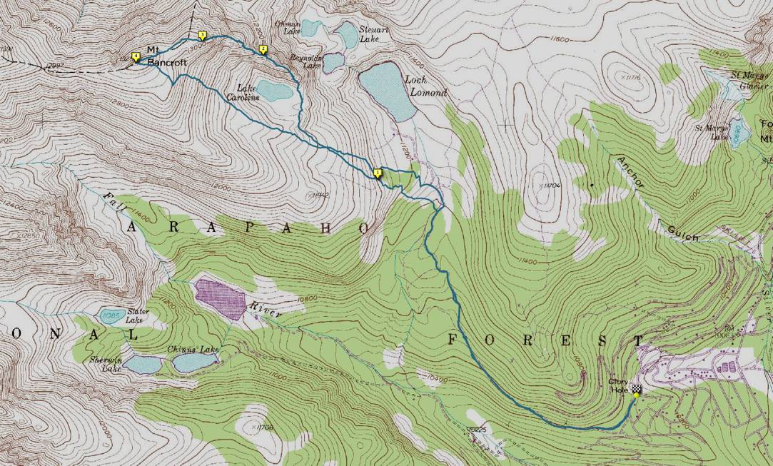
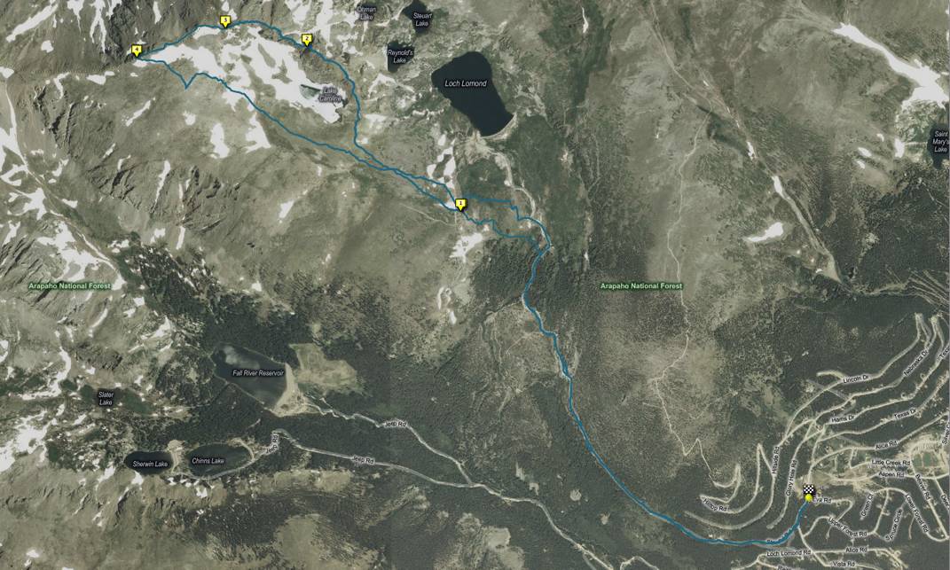
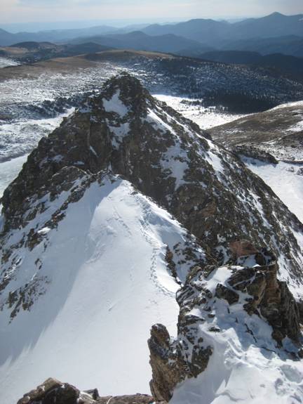
In the maps below, marker 1 is where I dropped my skis, 2 is the crux notch, 3 is the top of the ridge, and 4 is the summit. The track to the north is the one I took on the way up and other on the way down. You can see where I switch-backed a bit before I dropped my skis.
I left the house a little before 5 a.m. and arrived in Alice a little after 6 a.m. I wasn’t packed and took my time to get all my gear into the pack and to finishing dressing. I took a couple of GU’s with me and a 50-ounce bladder, which I had to sling inside my bibs, as usual, once the hose froze. I walked up the road to the start of the trail, which is really Stuert Road, but closed to traffic. I put on my skis and went less than a half-mile before I had to take them off to walk across a gap. I had to do this a number of times and even had to walk one stretch that was at least a quarter mile long.
Once I hit treeline the consistent, biting wind required me to don my wind shell, hat, neck gaiter, and mittens, but once I had those on, I was quite warm. After 2.4 miles, at 11,400 feet, I ditched the skis and went on foot. I immediately climbed a steep snowslope, which was quite hard. Normally, I’d put on my Microspikes, but I knew there was plenty of tundra and rock terrain to come and resisted. I followed some old steps and that eased my passage. I gained a ridge consisting of tundra and talus and followed it downwards to the base of the East Ridge proper. I followed more steps up a steep snowfield and then up some steep scrambling. The ridge really has a nice position and I enjoyed ever bit of it.
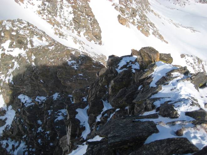
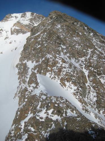
At 12,400 feet I hit the crux notch and immediately noticed the rappel slings and rings at the top of drop. It looked to be maybe 70 or 80 feet down to the lowpoint. I could see that some easy scrambling down to the right and carefully climbed down a ways. I figured if things didn’t look good there, I’d just climb back up to the slings. Once down about thirty feet or so, I spotted a second set of slings. Below the terrain appeared to be vertical and I made my way over to the slings, thinking that I’d rappel from there. I hate stopping and messing with the ropes and only had some slings for a harness, so I convinced myself that I could continue downclimbing. My ski boots are not the best climbing shoe, but I moved slowly and ensured that I always had a good handhold. The rock was quite accommodating in this respect and very positive, juggy holds always presented themselves.
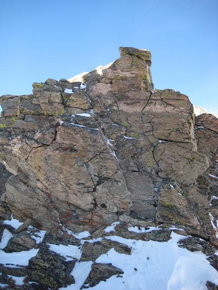
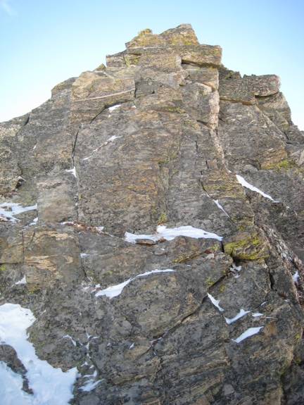
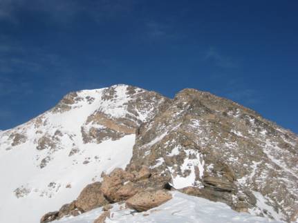
Once in the notch, I was faced with a nearly vertical wall about thirty feet high. At first it looked too difficult and I looked to the right for salvation. That looked worse and I faced the obstacle head on. There was a left-leaning corner that I was able to ascend with some careful stemming and some positive holds. The climbing here is only rated 5.2, but it had my attention in mittens and ski boots. Once over this barrier, the climbing eased, but it was still steep and exciting. I traversed an exposed snow ridge to more steep, great scrambling. The final section was quite moderate, but still very enjoyable climbing, not tiresome talus.
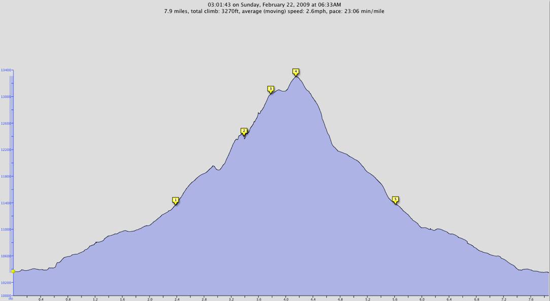
I topped the ridge in just under three hours after leaving the car. Making the true summit took another 15 minutes. Mt. Bancroft is 13,250 feet high and situated on the Continental Divide. I snapped some photos of James Peak, Mt. Parry, and Grays and Torreys in the distance. I headed down, keeping mostly to the hard, compact snow instead of the talus. The snow was hard in spots, but I was always able to at least kick a small footstep. Most of the time the footing was ideal and I made quick progress down the mountain, taking more photos of the ridge along the way.
When I got back to my skis I was surprised to see a pair of telemark skis stuck in the snow right next to mine. I hadn’t seen the other climber at all. I wasn’t looking, though. I wonder if he/she was climbing the East Ridge also. I put on my skis and headed down via a different, more direct route and found surprisingly nice snow. I did a few ungainly telemark turns and enjoyed working with gravity instead of against it. I got back to the road and picked my way down it, mixing it with hiking. I found a couple of snowshoers on their way up, carrying their snowshoes. These were the only people I saw all morning. On the way out I noticed the very enticing East Ridge of Mt. Eva. I might have to check out that mountain later this winter.
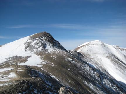
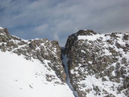
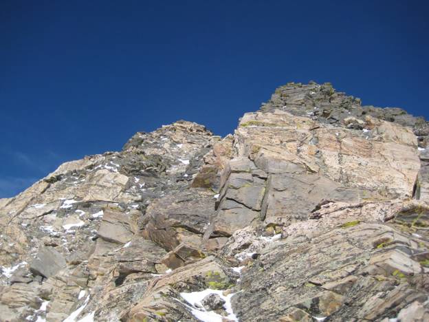
Photo right: Crux notch
Photo left : Mt. Bancroft on the left and Mt. Parry on the right.
I made it back to the car in just over 4.5 hours for the 8-mile, 3300-vertical foot outing. It was just past 11 a.m. and I was home before 12:30 p.m. This was a perfect, half-day adventure and allowed me to still spend most of the day with my family.
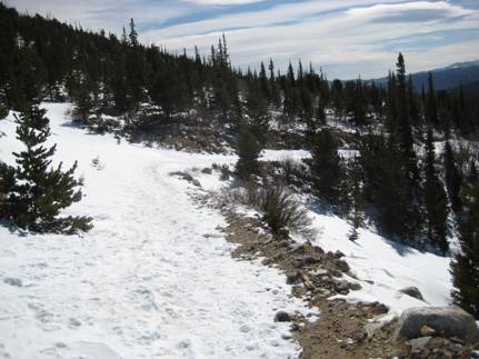
Photo above: Road approach
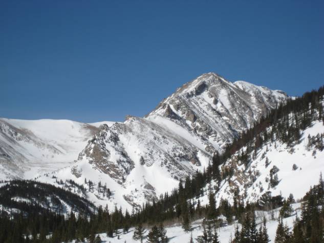
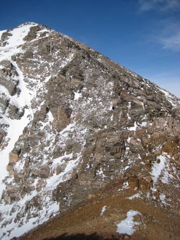
Photo above: The beautiful east ridge of Mt. Eva